 |
Way back in 2003 MLA’s Ray Danyluk, Jon Lord and Ivan Strang presented to the Minister of Community Development, Gene Zwozdesky, a “final report with recommendations for addressing the needs, issues and concerns related to existing trails and future recreation corridors in the province.” (A “recreation corridor” is considered a “continuous length of trail for recreation use”).
The report was titled the Recreation Corridors Legislative Review and was based on the input of “hundreds of Albertans” and organized around “five main areas of concern: liability; safety and policing; operation, maintenance and accountability; privacy and access; and environmental stewardship.”
The report also gave recommendation to adopt a committee to develop a trails designation program within the province.
In an Alberta government press release dated January 31, 2006 MLA Danyluk stated, “One result I want to see is detailed mapping of Alberta’s trails to help users plan their use of the trail system, and to help operators coordinate their services.”
And while it took a while for this committee to come to fruition, as most things do in government, finally the committee has been revived under the eye of Athabasca-Redwater MLA Jeff Johnson.
Since the 1970s Alberta’s population has doubled, bringing with it more recreational users leaving a footprint on Alberta’s landscape that can’t be ignored any longer.
And with OHV sales at all-time highs, more OHVs are showing up in Alberta’s backcountry than ever before.
But short of following the lead of radical environmental groups like the Yellowstone to Yukon Initiative (Y2Y), who would like to see Alberta’s Eastern Slopes void of human activity, especially recreational activity, what can we do to avoid situations like the destruction seen at the Indian Graves and McLean Creek areas west of Calgary?
Education doesn’t appear to be working as well as it should be, regardless of the stellar efforts put forth by groups like the Alberta Off-Highway Vehicle Association and the Alberta Snowmobile Association and others.
Enforcement has finally been applied to these areas as shown by the several hundred tickets issued this past May long weekend by as many as 50 enforcement officers, but policing Alberta’s backcountry is a huge undertaking and one that can’t be counted on in all areas at all times.
But progress is being made.
With initiatives like the Land-Use Framework coming into play, Alberta’s OHV owners are going to find themselves with several restrictions on what they can do and where they can do it. Beginning with Alberta’s Eastern Slopes.
Fast-forward to January 2008 and we have the first map in what will be a series of maps outlining Alberta’s recreational trails.
Known as “Northeast Alberta Trails” the map is the result of a partnership between government, Alberta TrailNet Society, Alberta Off-Highway Vehicle Association and the Alberta Snowmobile Association.
The map provides a general orientation of designated, managed trails in northeast Alberta and is the first information available in Alberta on recreational trails outside of parks. It should be noted that this map shows only the first layers of what will eventually be several layers of trails, each with designations in each of the planned regions province-wide (read Land-Use Framework) that each map will contain.
It was started here because of an extensive system of multi-use trails that exist, including the Iron Horse Trail and the Trans Canada Trail.
But what exactly does all this mean?
It could mean that one day your favourite trail may be available to anybody who chooses to pick up a map and discover how to access it.
 |
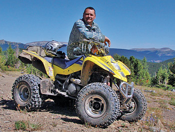
| Cal Rakach has worked tirelessly on behalf of OHV users across the province. |
According to Cal Rakach though, who sits on both the Alberta Recreation Corridors Committee as well as the Trail Designation Committee, this doesn’t necessarily mean your secret trail to moose camp will suddenly be available for all to see.
“If you have self-made trappers’ trails or a seldom used trail to moose camp, my hope is that layer won’t be on the map,” said Rakach, who is telling anybody who will listen that those trails should remain as they are.
And more than likely so because mapping such trails would be extremely extensive, and expensive.
But the kicker is if your trail intersects or is part of a larger trail that sees a fair amount of use, it will be mapped. In fact, Rakach has already been on the trail looking at areas that are used well enough to require funding for trail mapping.
And if your favourite quad trails are in the Eastern Slopes, you can bet they will be the first to receive designations regarding what can and what can’t take place on them.
“Random quading in our Eastern Slopes is coming to an end,” said Rakach, who also plays a lead role with the Alberta Off-Highway Vehicle Association and the Alberta Outdoors Coalition.
“But there could be opportunity here if we do it right,” Rakach continued. “We can lessen the impact on certain areas by dispersing users.”
Which may mean little more than moving recreational abusers deeper into the woods, something that doesn’t bode well with other users of the deep country, like hunters, anglers and trappers who may end up paying the price for the actions of a few.
According to the Recreation Corridors Legislative Review, “The Government of Alberta should set up an annual user fee to be collected on a province-wide basis (i.e. a ‘designated corridor pass’). A designated corridor pass could be issued by Alberta Registries offices, similar to an angling or hunting licence.”
It then goes on to say that, “Fees should be based on the level of recreation use (e.g. off-highway vehicle versus hikers) or on the corridor designation.”
Which, according to the Northeast Alberta Trails map, would be either a Multi-Use (including motorized), Non-motorized or Snowmobile recreational corridor.
But questions loom regarding who will maintain and enforce restrictions on our trails once they’ve been given a designation.
According to Rakach, the Alberta Recreation Corridors Committee is creating standards that volunteers can use to create or maintain existing trails. Each corridor (trail) will also have a trail operator or manager who will be responsible for the upkeep of their trail including the posting of signage, which could also result in the closure of a trail if deemed necessary for user safety or environmental concerns and other reasons.
“It’s a program that we need,” says Rakach. “But it is going to take time. It will sort of be like an evolution type of thing that will happen over the next several years.”
One can’t help wonder though that if at the end of the day, legitimate OHV users will be paying a steep price for the actions of a small group who just can’t seem to figure out that our environment isn’t there for them to abuse. ■
For previous Outdoor Pursuits click here.
|


